Sabado, Hulyo 30, 2011

MT. MATUTUM Tupi, South Cotabato

Mt. Matutum (2,293+)

MT. MATUTUM
Tupi, South Cotabato
Major jump-off: Sito Glandang, Brgy. Kablon, Tupi
LLA: 6°22'N, 125°06.5'E, 2293 MASL Days required / hours to summit: 1-2 days / 4-6 hours
Specs: Minor climb, Difficulty 5/9, Trail class 3

BACKGROUND
Beautifully rising in Tupi, South Cotabato, a town famous for its pineapple plantations, is Mt. Matutum. Its characteristic irregular but imposing cone shape dominates the landscape from General Santos to Koronadal City. It is so grand in its rise that it literally beckons climbers passing by the road from GenSan to Koronadal to climb it. Rising to 2293 MASL, it is considered a active volcano.

Realizing the need to protect the mountain, local officials have made it an ecotourism spot, regulating hiking activity. An interesting feature is the requirement for each climber to plant a seedling in a designated area in the mountain (a good idea!). The motto is "Amyak Maleh Matutum!": Climb and plant Matutum!

Commencing at Brgy. Kablon, the first leg is an open trail passing by rolling hillds surrounded with fields and plantations. An hour away is the first camp, which is also the entrance to the forest. There is a water source here. From this camp to the summit is 3-4 hours of trekking through a dense montane forest, full of vines, mosses, and the usual flora. This forest is host to diverse plant and animal species including the Philippine Eagle. In all, there are 110 plant species and 57 animal species.

At the summit, a 360-degree view is at hand, offering splendid views of General Santos City, Koronadal, and Polomolok, as well as Mt. Parker (NW), the Daguma ranges, and of course, majestic Mt. Apo (NE). A metal railing fences the viewdeck, and a marker bearing the history of the mountain as an ecotourist destination can be found. The summit is a suitable place for camping -- it is the highest point in South Cotabato.

ITINERARY

Day 1
0500 Take bus / transport to Tupi, South Cotabato
0900 ETA Kablon Crossing, Tupi. Take vehicle to Sitio Glandang
0930 ETA jump-off; register at Tourist Guard House / DENR
1100 Start trek
1200 Lunch at Camp 1
1300 Resume trek
1700 ETA summit of Mt. Matutum
1800 Dinner / socials

Day 2
0600 Breakfast / sunrise views
0700 Break camp
0800 Start descent
1200 Back at jump-off; return to highway
1300 Take bus back to Davao / GenSan / Koronadal

SPECIAL CONCERNS
The municipality of Tupi requests climbers to secure permission beforehand / coordinate with the Tourism office before climbing. a P150 climb fee is collected together with a P10 fee for seedlings. Guides may be secured at the tourism office, as well as porters.

Safety, a major concern especially among hikers from Luzon and foreigners, is generally assured in Mt. Matutum. Rain protection, insect repellants, are advised. 3 L of water would suffice for each climber from water source at Camp 1 until Day 2.

It is possible to dayhike Mt. Matutum, especially if you're coming from Koronadal or GenSan. It is comparable to Mt. Makiling (starting from the UPLB College of Forestry) in difficulty.

Mga etiketa: ,

KORONADAL CITY, SOUTH COTABATO

KORONADAL CITY, SOUTH COTABATO

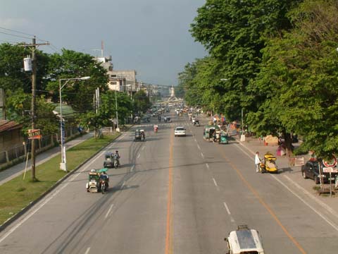
Koronadal City
Koronadal Highway
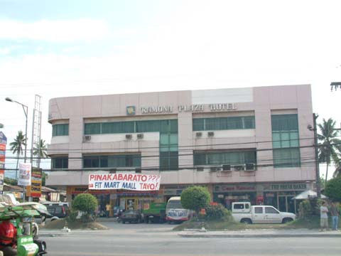
Koronadal ramona plaza hotel
Ramona Plaza Hotel
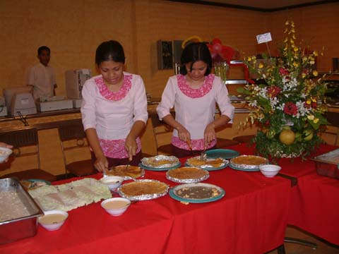
Koronadal restaurant
Koronadal Restaurant
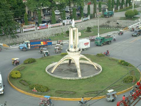
Koronadal round ball
Koronadal Round Ball
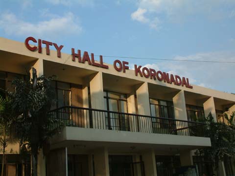
Koronadal city hall
Koronadal City Hall
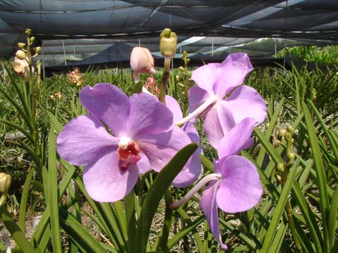
Koronadal orchids
Local Orchids
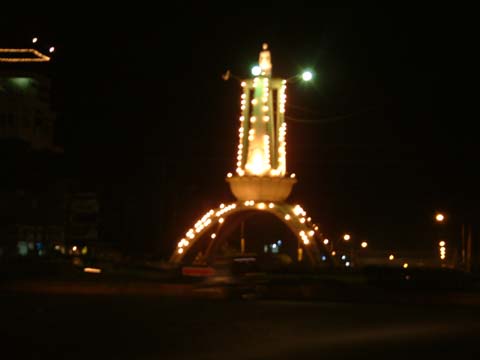
Koronadal round ball at night
Round Ball at Night
 KORONADAL CITYMindanao's Treasure Geography
Koronadal is situated in the northeastern part of the province of South Cotabato lying between 6 degrees 24 minutes to 6 degrees and 34 minutes north and longitude 124 degrees and 47 minutes to 124 degrees and 58 minutes east. The city is bounded in the northwest by the municipality of Tantangan, South Cotabato and the municipality of Lutayan, Sultan Kudarat in the northeast; on the southwest, by the municipality of Banga and on the southeast, by the municipality of Tupi and Tampakan, South Cotabato.

Koronadal is a fertile valley bounded by the Roxas Mountain Range on the southwest and Quezon Mountain Range on the northeast. Roxas Mountain Range extends from as far as Barangay Saravia on the southeast to Barangay Morales on the north, cutting through the Barangays of Carpenter Hill, San Isidro, Sta. Cruz, Mambucal, and the Poblacion. Quezon Mountain Range, on the other side, extends along the Barangays of San Jose, Mabini, Esperanza, Cacub and Zulueta.

History of Koronadal
Koronadal was converted into a component city of South Cotabato now known as the City of Koronadal by virtue of Republic Act 8803 on October 8, 2000. At present, Koronadal is a fast developing growth center composed of twenty seven (27) barangays including the four (4) zones in the poblacion. Being the capital town of South Cotabato, it is the center of the province in terms of political, cultural and socio-economic activities. Business firms and other establishments sprout in Koronadal. Identified also as the Provincial Agri-industrial Center of South Cotabato. Koronadal boasts of its favorable geographical location, rich human and natural resources, and potentials conducive for trade business and industry.

The settlement of Koronadal and its creation as a municipality by virtue of Executive Order No. 82 dated August 18, 1947 was marked by a rapid initial development, so that when the province of South Cotabato was created under Republic Act No. 4849 on July 18, 1966, it easily became the capital town. In the past, the place was populated by B'laans and Maguindanaos. The word Koronadal is believed to have been derived from two Maguindanaoan words- koron or kolon meaning cogon grass and nadal or datal meaning plain which optly described the place to the natives. On the other hand, Marbel, which is another name for the poblacion, is a B'laan term "Marb-El" which means "murky waters" (it is possible that name was first used to) referring to a river, now called Marbel River.

Koronadal used to comprise the area extending from the banks of Buluan Lake to the north to Barangay Polonoling in the municipality of Tupi to the south from Quezon mountain range to the northeast to the municipality of T'Boli to the southeast.

It was in August 18, 1947 when President Manuel Roxas signed the Executive Order creating the municipalities in the entire province of South Cotabato, one of which was Koronadal. The same executive order likewise mandated the official function of the municipal government which began after the qualification and election of the first set of municipal officials. Elected were Datu Kudanding Kamsa, Municipal Mayor, Perfecto Sueno Sr., Vice Mayor; Councilors: Porferio Cuenca, Felix Suscano, Alejandro Poticar, Gregorio Hechanova, Zacarias Cadule, and Dencio Sarate. The first Municipal Judge was Braulio Hurtado and the first Health Officer was Dr. Felimon de Jesus, Cornelio Mariveles became the Chief of Police and Godofredo Gazo, the Municipal Secretary.

The municipal government of Koronadal began its official function on January 1, 1948 with an approved Annual Estimated Budget of P30,000.00. The land area of the municipality by then was comparable with the Province of Bata-an embracing the present municipalities of Tampakan, Tupi, Banga, Lake Sebu, Surallah, T'Boli, Sto. Niño, Norala, and Isulan. Municipal Council Resolution No. 32, Series of 1948 mandated and proclaimed January 10 of each year as the Municipal Town Fiesta commemorating the foundation of Marbel Settlement District of the National Land Settlement.

Climate 
Records from PAG-ASA in General Santos City show that the average annual temperature of Koronadal for the past five years is 27.07 degrees centigrade. Warmest temperatures in the city occur during the months of April and October while the coolest in December to January. Temperatures below the annual average are felt in the upland areas of Barangay Assumption, Paraiso and Sta, Cruz. The average relative humidity of Koronadal varies. As of 1976, it was registered at 28.36 degrees centigrade. Rainfall distribution in the city is more or less even throughout the year. Because of the mountain ranges, tropical depressions rarely affect the city. 

Mga etiketa: ,